Mohammad Reza Alizadeh, Massachusetts Institute of Technology (MIT) and Mojtaba Sadegh, Boise State University
As wildfire risk rises in the West, wildland firefighters and officials are keeping a closer eye on the high mountains – regions once considered too wet to burn.
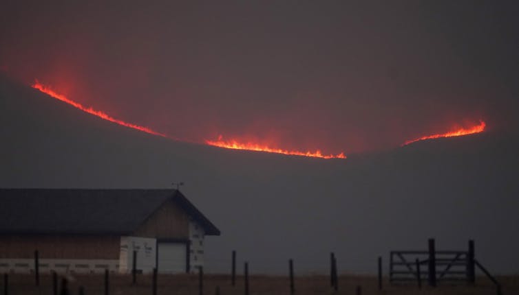
The growing fire risk in these areas became startling clear in 2020, when Colorado’s East Troublesome Fire burned up and over the Continental Divide to become the state’s second-largest fire on record. The following year, California’s Dixie Fire became the first on record to burn across the Sierra Nevada’s crest and start down the other side.
We study wildfire behavior as climate scientists and engineers. In a new study, we show that fire risk has intensified in every region across the West over the past four decades, but the sharpest upward trends are in the high elevations.
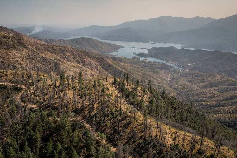
High mountain fires can create a cascade of risks for local ecosystems and for millions of people living farther down the mountains.
Since cooler, wetter high mountain landscapes rarely burn, vegetation and dead wood can build up, so highland fires tend to be intense and uncontrollable. They can affect everything from water quality and the timing of meltwater that communities and farmers rely on, to erosion that can bring debris and mud flows. Ultimately, they can change the hydrology, ecology and geomorphology of the highlands, with complex feedback loops that can transform mountain landscapes and endanger human safety.
Four decades of rising fire risk
Historically, higher moisture levels and cooler temperatures created a flammability barrier in the highlands. This enabled fire managers to leave fires that move away from human settlements and up mountains to run their course without interference. Fire would hit the flammability barrier and burn out.
However, our findings show that’s no longer reliable as the climate warms.
We analyzed fire danger trends in different elevation bands of the Western U.S. mountains from 1979 to 2020. Fire danger describes conditions that reflect the potential for a fire to ignite and spread.
Over that 42-year period, rising temperatures and drying trends increased the number of critical fire danger days in every region in the U.S. West. But in the highlands, certain environmental processes, such as earlier snowmelt that allowed the earth to heat up and become drier, intensified the fire danger faster than anywhere else. It was particularly stark in high-elevation forests from about 8,200 to 9,800 feet (2,500-3,000 meters) in elevation, just above the elevation of Aspen, Colorado.

We found that the high-elevation band had gained on average 63 critical fire danger days a year by 2020 compared with 1979. That included 22 days outside the traditional warm season of May to September. In previous research, we found that high-elevation fires had been advancing upslope in the West at about 25 feet (7.6 meters) per year.
Cascading risks for humans downstream
Mountains are water towers of the world, providing 70% of the runoff that cities across the West rely on. They support millions of people who live downstream.
High-elevation fires can have a significant impact on snow accumulation and meltwater, even long after they have burned out.
For example, fires remove vegetation cover and tree canopies, which can shorten the amount of time the snowpack stays frozen before melting. Soot from fires also darkens the snow surface, increasing its ability to absorb the Sun’s energy, which facilitates melting. Similarly, darkened land surface increases the absorption of solar radiation and heightens soil temperature after fires.
The result of these changes can be spring flooding, and less water later in the summer when communities downstream are counting on it.
Fire-driven tree loss also removes anchor points for the snowpack, increasing the frequency and severity of avalanches.
Frequent fires in high-elevation areas can also have a significant impact on the sediment dynamics of mountain streams. The loss of tree canopy means rainfall hits the ground at a higher velocity, increasing the potential for erosion. This can trigger mudslides and increase the amount of sediment sent downstream, which in turn can affect water quality and aquatic habitats.
Erosion linked to runoff after fire damage can also deepen streams to the point that excess water from storms can’t spread in high-elevation meadows and recharge the groundwater; instead, they route the water quickly downstream and cause flooding.
Hazards for climate-stressed species and ecosystems
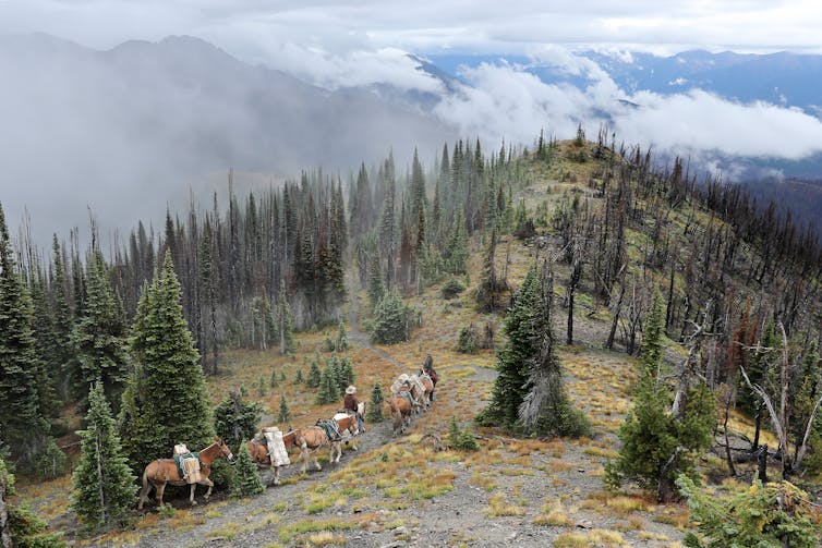
The highlands generally have long fire return intervals, burning once every several decades if not centuries. Since they don’t burn often, their ecosystems aren’t as fire-adapted as lower-elevation forests, so they may not recover as efficiently or survive repeated fires.
Studies show that more frequent fires could change the type of trees that grow in the highlands or even convert them to shrubs or grasses.
Wet mountain areas, with their cooler temperatures and higher precipitation, are often peppered with hot spots of biodiversity and provide refuges to various species from the warming climate. If these areas lose their tree canopies, species with small ranges that depend on cold-water mountain streams can face existential risks as more energy from the Sun heats up stream water in the absence of tree shading.
While the risk is rising fastest in the high mountains, most of the West is now at increasing risk of fires. With continuing greenhouse gas emissions fueling global warming, this trend of worsening fire danger is expected to intensify further, straining firefighting resources as crews battle more blazes.
Mohammad Reza Alizadeh, Postdoctoral Researcher in Environmental Engineering, Massachusetts Institute of Technology (MIT) and Mojtaba Sadegh, Assistant Professor of Civil Engineering, Boise State University
This article is republished from The Conversation under a Creative Commons license. Read the original article.