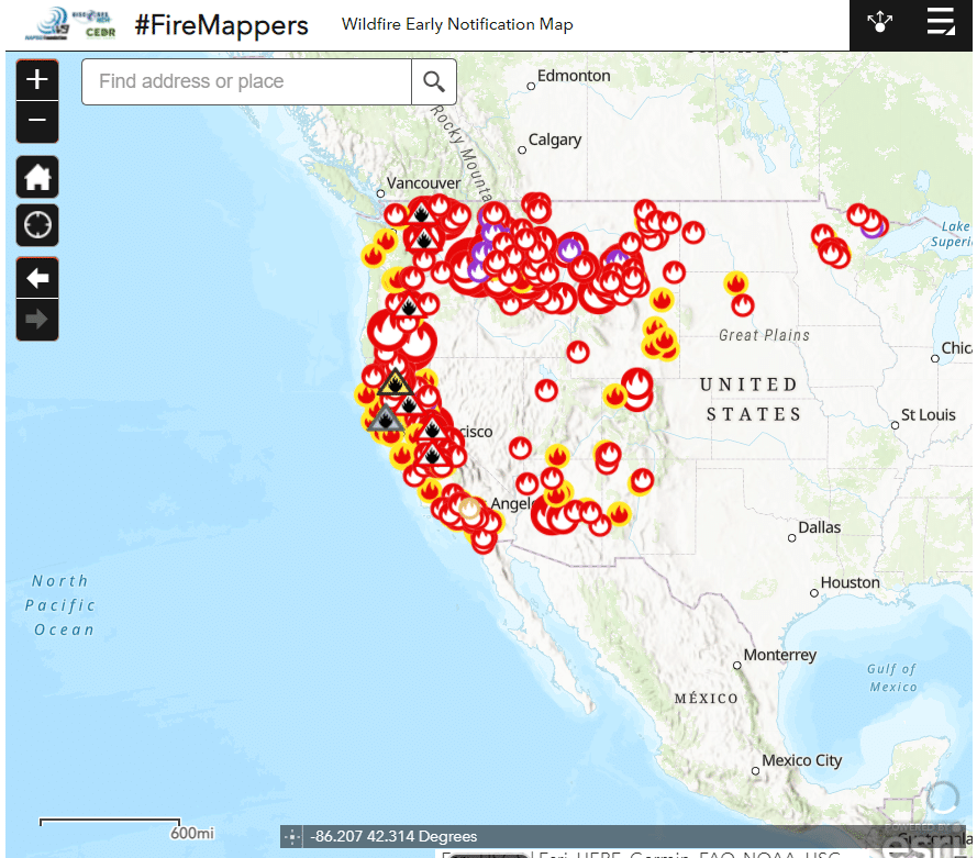
It is difficult to always be updated on the latest fire incidents with several wildfires occurring at one time, with some burning 100, 000 acres, in some parts of California.
The University of California Division of Agriculture and Natural Resources has thought of a way to visualize the scenarios easier by putting together an interactive map.

The map shows active and fires that were contained recently, along with the locations that were labeled with the red flag warning.
However, it does not serve as a tool for evacuation purposes or real-time threats. The local government has put up an alert system for these needs, or the Cal Fire can also be contacted.
The map has shown the most active fires when it happens, like the ones in the Beckwourth Complex in the Plumas National Forest which covered 105, 348 acres. Also shown was the Tamarack Fire near Markleeville, covering 18,299 acres; and Dixie Fire near Paradise with 15,074 acres.
So far, for 2021, the Beckwourth Complex Fire 50 miles north of Tahoe became the largest wildfire. On Thursday, it was declared to be the state’s first megafire for this year as it already went beyond 100, 000 acres.
While megafires are not a usual occurrence, in California, it has grown to become more ordinary. This was attributed to the extreme weather events that hit the state repeatedly, like drought, dry lightning, and heatwaves.
The state data shows that 17 out of the 20 fires that hit the state have spared after 2003, the last year when massive fires are still rare in California, SFGate reported.
Apart from the map, the Cal Fire incident page also shows more information regarding wildfire conditions.


